CECE Incubator Grant Project: Remote Sensing and Knowledge Co-Production in Northern Haiti
Right now, Haiti is in a moment of intense political crisis, and gangs in urban Port-au-Prince have a stranglehold on the country’s economy. In the countryside, this means food, medicine, and other commodities are extremely expensive and hard to obtain. In this chaotic moment, this collaborative research continues to support civil society groups who are working on novel methods for preventing land grabs by large institutions and the politically powerful. With the current vacuum of state power, these issues are even more urgent.
In 2022, motivated by the threat of further land grabs and mining activities, a Haitian grassroots organization (AREDE) formed an international partnership using participatory action research as a preventative measure to document land use and change. The nascent land rights observatory in northern Haiti is a partnership between AREDE (Action for Reforestation and Defense of the Environment), the NYU Global Justice Law Clinic, anthropologist Scott Freeman of SIS, and Mike Alonzo of Environmental Science. The observatory has two key goals: 1) preventing further displacement, and 2) understanding environmental changes affecting health and agricultural productivity.
AREDE in Haiti has been working to identify specific sites of vegetative change on the ground so that our AU team can work on the corresponding remote sensing images. The result is the combination of citizen-driven political and environmental concerns that then are complemented with remote sensing analysis. In short, the first phase of this work is Haitian partners identifying specific areas where land grabs have occurred, and then looking together at satellite records over time to analyze the resultant patterns of change (e.g., degradation, industrialization) on the landscape. This analysis will lead to an expanded set of questions. These iterations between satellite data and local knowledge will ultimately help us understand patterns of land use and change and how they relate to land grabs that have occurred in the region.
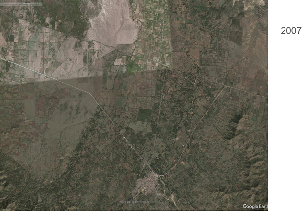
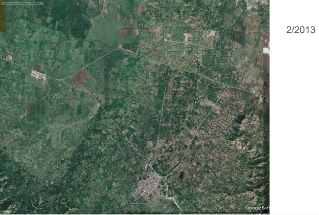
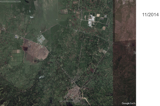
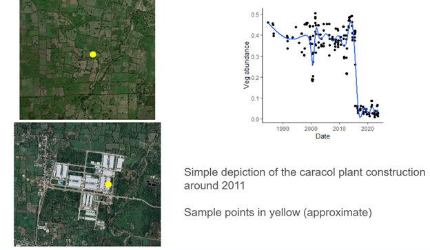
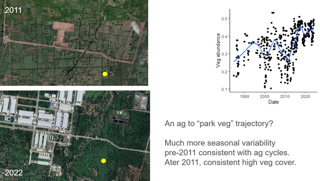
Even at this early stage we are already detecting the importance of the nuanced politics of reforestation and deforestation. Preliminary analysis in areas of land grabs actually show areas of increased forestation. Rather than a positive outcome however, this work shows how areas of increased forest cover may also be the result of coercive land grabs, as occurred in the case of the Caracol Industrial Park.
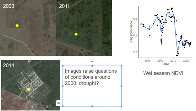
Remote sensing data also reveals drastic reduction in vegetative cover prior to the land grab in question. Now, the Haitian team will take this information and work through oral histories of the area to understand what other phenomenon, like drought or other human led changes, might reveal about those moments in time.
Ultimately, establishing this set of baselines helps make land change and land grabs visible and demonstrable. As the project moves forward, the hope is to establish a way that localized histories and remote sensing can be used not only demonstrate, but prevent further land grabs. The baseline data also contributes to conversations on the ground about the multiple values of land. These are essential conversations as attempts at land grabs may coercively buy out smallholders and attempt to monetize an invaluable resource.